September 23 slideshow

SHARE THIS:
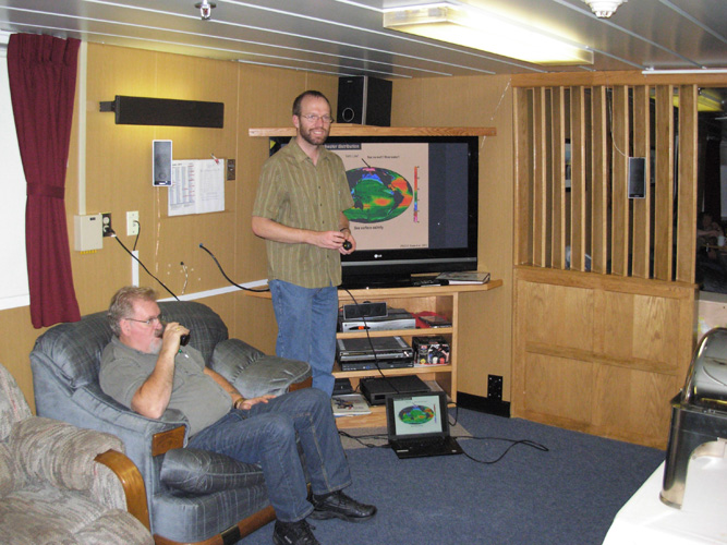
I give the first science presentation of the cruise describing the scientific studies being conducted during the cruise.
(Rick Krishfield)
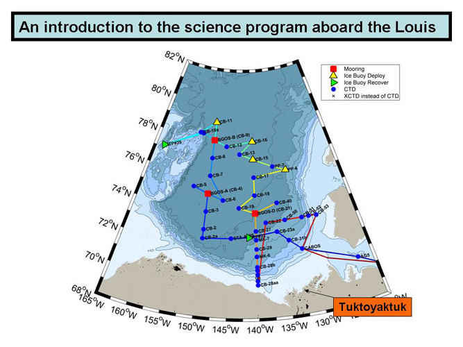
The first slide of the presentation shows the planned cruise track (which has not been closely followed so far) and the location of Tuktoyaktuk where we are to receive fuel. After refueling, we intend to pick up the original cruise track at the location marked STA A (~72.5° N, 145° W).
(Bill Williams)
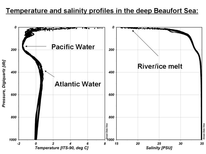
Another plot from the presentation shows typical profiles of temperature and salinity in the Beaufort Sea, with the major water masses indicated.
(Bill Williams)
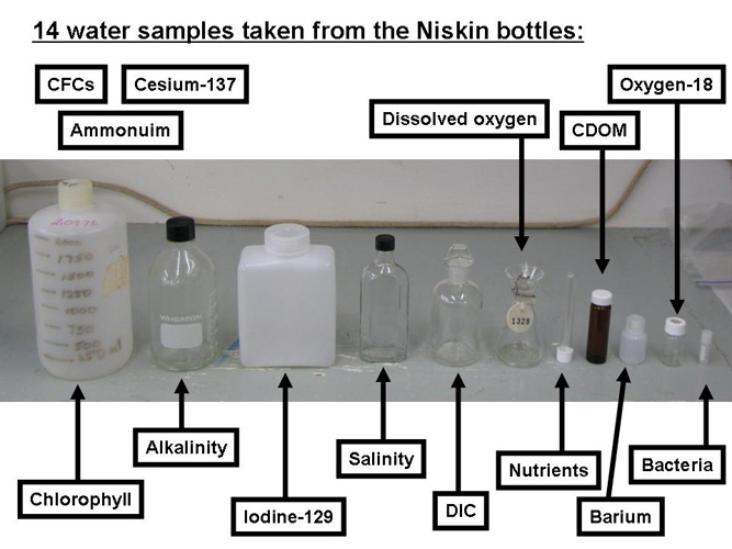
Quite a bit of the presentation revolved around this slide which shows which sample containers are used to collect each biological or chemical water sample. The bottles were identified pictorially with the corresponding scientist on board, their laboratory apparatus, and example plots of the data.
(Bill Williams)

Image and Visual Licensing

Text, images, graphics and other material contained on this website are subject to copyright. For more information or to license material, please contact the Director of Digital Assets, images@whoi.edu or (508) 289-2647.

Explore Visual WHOI

Search multimedia database

License our Visuals