Autonomous Underwater Vehicle ABE
The Autonomous Benthic Explorer, ABE, was lost at sea during a research cruise in March 2010 off the coast of Chile. Learn more »
The Autonomous Benthic Explorer (ABE) is a robotic underwater vehicle used for exploring the ocean to depths of 4,500 meters (14,764 feet). It was the first AUV used by the U.S. scientific community. ABE is often used in tandem with Alvin or Jason surveying large swaths of oceanfloor to determine the best spots for close-up exploration.
ABE is designed to perform a pre-programmed set of maneuvers, using its five thrusters to move in any direction, hover, and reverse. The AUV excels at surveys of the shape of the seafloor (bathymetry), its chemical emissions, and its magnetic properties. ABE is particularly valuable in rugged terrain. Onboard sensors tell the vehicle how deep it is and how far it is off the ocean floor, and the AUV calculates its horizontal position by contacting a system of acoustic beacons (transponders) set out in fixed locations.
Since its launch in 1996, ABE has made more than 200 dives, surveying an average of 16 kilometers (10 miles) per dive. The vehicle has been used to locate, map, and photograph many deep-sea hydrothermal vent sites and volcanoes. Geologists use ABE’s magnetic readings to understand the evolution of the Earth’s crust.
Some observers believe ABE looks like the Enterprise from the Star Trek science fiction series. The shape helps the vehicle remain stable in deep-sea currents. Most of ABE’s flotation resides in the top two pods, with instruments and other gear housed in the bottom. The separation of buoyancy and mass makes ABE resistant to pitching and rolling. The resemblance to Captain Kirk’s space ship is coincidental, but ABE’s design team did stencil "NCC1701"—registry number of the fictional Enterprise—on the hull for fun.
Multimedia
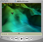
video
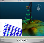
ABE Animation
Maintaining a constant altitude and precision navigation, ABE is programmed to fly back and forth over the seafloor (which scientists call "mowing the lawn"), surveying the seafloor with sonar to create high-resolution bathymetric maps.



 Facebook
 Twitter
 Instagram
 Vimeo
Vimeo YouTube
 LinkedIn
 RSS Feeds


