This is an archived site. This site is no longer being maintained or reviewed for broken links.

Please note: You are viewing the unstyled version of this website. Either your browser does not support CSS (cascading style sheets) or it has been disabled. Skip navigation.

Image : Background on Gakkel Ridge, Arctic Exploration, and Hydrothermal Vents


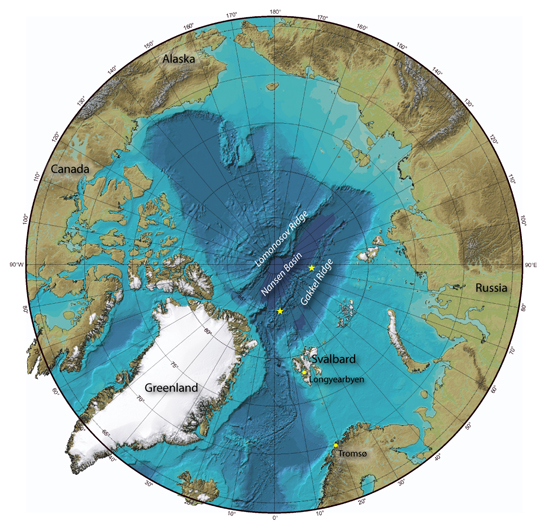
Map of the Arctic Ocean, looking down on the North Pole, shows the Gakkel Ridge, Nansen Basin, and the Lomonosov Ridge. (Data from the International Bathymetric Chart of the Arctic Ocean and the National Geophysical Data Center; with graphic enhancements by Jack Cook, Woods Hole Oceanographic Institution)

[back]


Last updated: October 26, 2010


whoi logo

Copyright ©2007 Woods Hole Oceanographic Institution, All Rights Reserved, Privacy Policy.
Problems or questions about the site, please contact webdev@whoi.edu