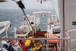
Cruise goals:The main goal of the cruise is to shed light on the origin of the water that flows through Denmark Strait (between Greenland and Iceland). This includes the water on the outer shelf (which ultimately makes it to where the moorings were) as well as the dense "overflow water" that flows through the middle of the Strait and subsequently desends in the Irminger Sea. There are different ideas as to where this water originates. For instance, one scenario is that the East Greenland Current carries both the shelf water and the dense water through the western side of the Strait. A second theory, recently put forth by researchers in Iceland, suggests that the densest water enters the eastern side of the Strait from the Iceland Sea. There is probably no simple answer, but we hope that our measurements will add to the story. It is of utmost importance to understand where and how the dense water is formed, and how it negotiates Denmark Strait to form the boundary current in the Irminger Sea (and beyond). A second goal is to investigate the source of the recently established East Greenland Coastal Current. It has been investigated south of Denmark Strait, but we don't know whether or not this current exists north of the Strait. A third goal is investigate the amounts and type of phytoplankton (microscopic marine plants) carried from the north in the East Greenland Current / Coastal Current. Our measurements will shed light on this. The final goal of the cruise is to learn more about the nature of the storms that pass through this region. Our area of operations is right along the North Atlantic storm track, and these storms are believed to influence the currents measured by the moorings. Since the cruise is in October (the beginning of the storm season), we should have opportunities to make atmospheric measurements during some storms. Cruise itinerary:The cruise will depart Reykjavik, Iceland the morning of October 3rd; it is approximately a 24-hour steam to the mooring line. We will take measurements with the CTD along a line as we recover the moorings (much of the CTD work will occur during evening hours). VPR casts will be done in the vicinity of the shelfbreak. Upon completetion of the CTD line and the recovery of the moorings, we will head north occupying CTD sections between Greenland and Iceland as we progress towards the northern mooring site. After recovering the northern mooring we will continue occupying CTD sections that extend from Greenland into the Iceland Sea, until it's time to depart for Reykjavik. Last updated: September 16, 2008 | |||||||||||||||||
Copyright ©2007 Woods Hole Oceanographic Institution, All Rights Reserved, Privacy Policy. | |||||||||||||||||