 | 1: 15th Expedition to the Beaufort Gyre of the Arctic Ocean
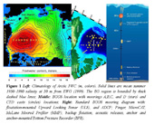
In 2017, the Joint Ocean Ice Study (JOIS) and the Beaufort Gyre Exploration Program (BGEP, www.whoi.edu/beaufortgyre) projects’ field work conducted by the scientists from Fisheries and Oceans Canada and Woods Hole Oceanographic Institution (WHOI) will be continued, completing the 15-year cycle of annual late summer - early autumn operations in this remote region of the Arctic Ocean. |
 | 2: Embarked
Yesterday was mostly a day of travel. First was a two-hour flight from Yellowknife to the small village of Cambridge Bay. The flight was mostly folks on the JOIS cruise. From there we were air-lifted by helicopter from the small airport to the ship. Then it was all about the common experience of retrieving bags, finding your berth, unpacking, orientation, dinner (ribs yum!), more unpacking, and for the newbies, getting familiar with the labyrinth of decks, stairwells and hallways. My task was to wander around aimlessly for a while and then try to find my way back to my berth. “Kinda worked, kinda didn't.” |
 | 3: Its a Plan
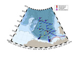
The Joint Ocean Ice Studies (JOIS) 2017 expedition has a plan. Actually there are lots of individual plans but they all have to be carefully coordinated and choreographed so that there is as much efficiency as possible built into the system. That responsibility falls to Bill Williams. He is the leader and guru of the JOIS 2017 expedition. |
 | 4: Sponge Bobber Overboard and Semi-science Fiction
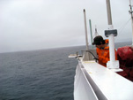
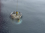
Things are starting to fall into a routine. There are still many pieces of equipment to set up but the CTD casts are happening routinely and the required onboard sample processing and analysis are well underway. CTD stands for Conductivity, Temperature and Depth. Along with those three measurements being made there are 24 bottles that can be opened and closed remotely (Niskin Bottles) so that water samples can be taken at numerous depths throughout the cast. |
 | 5: Tiny Bubbles and Semi-science Fiction
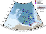
We are currently on a run headed east towards Banks Island with rosette CTD casts occurring about every 3 to 5 hours apart. Its all fairly routine at this point: rosette is cast, rosette is retrieved, samples are taken, samples are processed, samples are analyzed or stored, and repeat. Seita's equipment is working well and is busy storing data about the ice as we pass through it. Preparations for the first mooring operation are well underway with some "in deep" trouble shooting going on with a couple of pieces of new equipment. |
 | 6: Tiny Bubbles
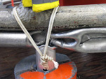
Late yesterday we set a course to the northwest heading for our next two stations CB40 then CB18. We did, however, spend some extra time at CB51. The first attempt at a rosette CTD cast had to be aborted because of communications issues. Since the two individuals who knew how to troubleshoot the equipment were asleep, Marshall Swartz (WHOI) stepped up and had things working after a couple of hours. While Marshall was busy working on repairs, several of us were dining in luxury at the Captain's Table Sunday Dinner. This is a traditional weekly event that brings together the ship's Captain, some of his Officers and invited guests from the ranks of the supernumeries (the science staff). It was my perception that the Captain's Dinner was such a big deal that they actually stopped the ship so the dinner could be served without the bouncing and jostling that goes along with sailing through the ice. Turns out we were hanging around at CB51 so that when the rosette was indeed repaired the station could be sampled. |
 | 7: Headed North
We are on an easterly run towards station PP6 and then will turn back towards the northwest heading for stations PP7 and CB15. By days end we expect to be heading directly north towards station CB16 and then farther north. Possibly as far north as 83ã‹âšN (only 7 degrees or 777 km or 486 miles from the North Pole!) in search of suitable ice for the first "ice ops" station. We had a mishap with the rosette frame. The rosette frame extension, added this year, imploded at the huge depth (3600 meters). Turns out that there was no way for the air inside the tube to escape so under the large pressure differential of being at 3600 meters the hollow tube imploded (you can see the photos in the Sept. 12th photo gallery). |
 | 8: Voice of an Angel
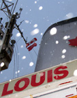
Our overnight northwesterly run towards PP7 was slowed somewhat. Persistent and rather thick blocks of ice and heavy fog kept the ship cruising at about 7 knots which is somewhat slower than our normal cruising speed of 10-12 knots. We expect to be headed north later in the day. |
 | 9: In Search of Ice
After finishing work at Station CB16 at about midnight last night, we are now headed in a northeasterly direction in search of suitable ice for the first ice station. We have been travelling at about 8 knots through plenty of ice since late yesterday but it is all in the 10 to 30 centimeter range and an ice station ideally will be on 2-3-meter multi-year ice. A helicopter flight is planned for later today IF the weather improves. |
 | 10: On Ice
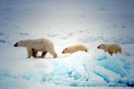
Late last night we arrived at our now most northern point and first ice station which meant we would be on ice for a good chunk of the day. Our first ice station was coincidently our first Polar Bear sighting: a mother and two cubs. Because the ice was in the 1-2 meter thick range, it was decided to do all of the "ice ops" right off of the starboard side using the gangway for deploying the people and ship’s crane for moving the heavy equipment onto the ice. Luckily the bears were spotted about 300 meters off the port side but an armed lookout was sent out on the ice first. Two teams spent about four hours on the ice, the ice survey team and the ITP deployment team. |
 | 11: On Ice Again
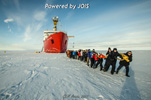
After Ice Station #1 yesterday we headed towards the southwest for our second ice station of the trip. I was a bit turned around when I got off the ship at about 9:30 am because the ships bow was pointed towards the southeast, at least that was what I concluded by looking at the sun's position.... the sun still rises in the east and sets in the west right? The ice station deployment, although much colder than yesterday, was pretty uneventful: equipment lowered onto ice, people get on the ice via the gangway, holes augured, ITP assembled and positioned, IMB placed in its ice hole, ice survey completed including ice cores, and we were all back on the ship by 1:30 pm ready to roll. |
 | 12: Direct Observation
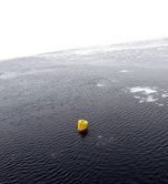
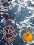
Overnight we made our way south and west stopping along the way for a couple of overnight XCTD casts and arriving at station CB11b for the final ITP deployment. Since the ice has thinned considerably it was decided to deploy the ITP and its buoy into open water rather than onto the ice since it will probably just fall through the ice anyway. Turns out the water deployed ITP's do pretty well in the open water because the ice will form around them incorporating them into a new ice floe. The deck deployment of an ITP is similar to the ice in many respects with the sequence of events being pretty much the same. Rather than using a tripod to lower the 280 pounds of anchor weights, cable, ITP, and buoy, the ship’s forward deck cranes were used to pull off the job. Once the ITP deployment was completed, we began to head directly south to stations CB11, CB10, and eventually CB9 which is also our first mooring station referred to as BGOS-B or simply Mooring Station B. |
 | 13: Mooring Operations (Ops)
The past three days have been mostly dedicated to "ice ops" and the deployment of the ITPs and Ice Mass Balance Buoys (IMBs). Today is the first of several days of "mooring ops" and basically ITP/IMB deployment was the warm-up for the mooring deployments. Everything about the mooring station is bigger-much bigger. The buoy for an ITP is a Styrofoam cone about 3 feet in diameter and weighs less than a hundred pounds. The buoy for a mooring is metal sphere about 5 1/2 feet in diameter and weighs about 2500 pounds. The cable for the ITP is about 800 meters long (1/2 a mile) and the cable for the mooring is about 3800 meters long (2 1/2 miles). The anchor weights for the ITP is about 280 pounds and the anchor weights for the mooring comes to about 4500 pounds. There are three sensors on the ITPs which we deployed this year (pressure, conductivity and temperature) and there are at least 8 sensors on the mooring stations. Installation time for an ITP is about 3 hours, and the recovery and redeployment of the mooring takes about 24 hours. |
 | 14: Mooring Ops Day 2
If you look at our position today and compare it to yesterday's position you could easily infer that we have been in the same place for the past day...but we have not. After the mooring was recovered yesterday we made our way towards the southeast to station CB12.5 at 77˚ 30’N, 145˚ 00’W. At station CB12.5 we did the scheduled CTD cast and then turned around and came back, so we started today in the same spot as yesterday with a few nautical miles covered out-and-back in between. AND we are back where we started because today is mooring deployment day. |
 | 15: Bombin' Down the 150˚W Line
Yesterday after the successful deployment of Mooring B we started heading south on the 150ãã¢âã¢â‚â¬â¹âã...â¡ W line stopping along the way at two CTD stations CB8 and CB7 and arriving at CB4 mid-morning. Station CB4 is also known as the BGOS-A station which is the second mooring station: Mooring A. The mooring recovery work went fairly smooth, although the rougher seas made things a little tricky. A twenty-five hundred pound mooring float hanging on the end of a cable from the arm of a crane has a mind of its own as the ship rocks and rolls in the swells. But when the dust settled all was where it was supposed to be and in one place. I took some GoPro shots from the end of an 18-foot pole that offered a little different perspective. |
 | 16: Aurora Borealis
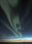
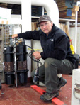
Aaagh, the elusive Aurora Borealis aka Northern Lights. We southerners who come from the lower latitudes rarely if ever get a chance to see them. Usually when we do it is kind of a let down because they are faint or obscured by clouds etc. and we are left saying that the pictures of the Aurora Borealis are better than seeing the actual thing. BUT to this southern latitude soul, that changed last night. I was just drifting off to sleep when my beeper went off. Strange I thought, why would the bridge be beeping me at 11 pm? |
 | 17: Barrow
We are headed to Barrow.... Alaska that is. Normally when I think of going to Barrow I think of it in terms of approaching from the south-something like Missoula to Seattle to Anchorage to Fairbanks to Barrow gets you there. But we are approaching from the north and truth be told I will not actually set foot in Barrow (not that I have set foot there before approaching from the south either). The BL (Barrow Line) section was finished up early this morning and now we are headed west towards Barrow with an ETA of noon. We are to pick up batteries and some fresh vegetables but because of various US Customs restrictions, only the helicopter pilot will go to Barrow. The rest of us will watch. |
 | 18: Visitors
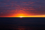
We had some visitors early this morning but they did not come aboard. The USCGC Healy was spied as the sun was rising way off in the eastern horizon. The Healy is an icebreaker from the United States and has worked with the Louis S. St Laurent for three years, 2008-2010, on the Extended Continental Shelf Survey a series of seafloor mapping efforts. This survey discovered the Savaqatigiik Seamount at 81˚ 32’16N and 134˚ 33’48W on August 25, 2009 and a plaque on the Louis commemorates the occasion. Gina Nicoloff (DFO-IOS) got a couple of nice photos of the sunrise and the Healy. |
 | 19: Life on the Louis
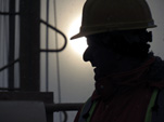
It occurred to me that life on the Louis is something that should be visited. There is a certain rhythm of the day to day going ons that somehow fills in between sample analysis, data processing, being "on station" either doing CTD rosette casts, Bongo net casts, or mooring recovery and deployment operations. Most on the science crew have established a wakeup time and a hit-the-hay time but it varies depending on which watch (day or night) they are on. I start my days at 6:30 am ship time which changes depending on which time zone we are in. |
 | 20: The CTD Rosette
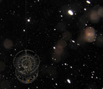
After the successful redeployment of Mooring Station A last night we steamed to the east and found ourselves at Mooring Station D aka CB21. This is the last of the mooring stations and will involve two days of work. Today is all about recovery, then we will do a little triangle overnight hitting a couple of CTD rosette stations (CB27 and CB22) then wind up back at Mooring Station D at daybreak for redeployment. By the way, CB22 was already done earlier in the cruise. |
 | 21: Shout Out!
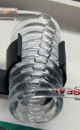
I want to start out today by saying a "Good Day eh" to Ms. McDonald's classes at Saint James Regional High School in Portauxeasque, Newfoundland. Ms. McDonald's father is Quartermaster, David Pike on the Louis S. St. Laurent and he was charged with transferring a collection of 85 Styrofoam cups (see photos) to the ship for the annual "shrinking of the cups". This ritual utilizes the daily CTD rosette casts to submerge the cups to depths of 1000+ meters where the pressure is well above atmospheric pressure. The big squeeze is put on the cups at those depths and the outcome is fairly amusing. Will post the results in a couple of days. |
 | 22: Shrunken Cups and CDOM
Last night’s out-and-back trip towards the northwest took us to a couple of CTD rosette stations, CB6 and later CB19 on the return. So we are back at Mooring Station D aka CB21 for a second try at a mooring re-deployment. Winds have dropped and seas have calmed but the skills of the Bosun crane, winch operators, and mooring technician will be tested. |
 | 23: Big Swells
Yesterday’s mooring deployment at Mooring Station D aka CB21 was successful albeit tricky with significant swells. The mooring crew was pretty worked by day’s end. You could see noticeable grimaces on some faces as expensive research equipment clanged on the ships hull as it was being lowered. Once an instrument has been put over the side of the ship there is no going back to see how it is working until next year to see if data was indeed being collected. So....just drop it in and hope for the best in these big swells. |
 | 24: Arctic Microbes
Our track is now heading south to the MK line (see Slide 1) where a series of CTD rosette casts are being done along the Beaufort Shelf moving from deep water to relatively shallow water. Seas are quite rough today with swells in the 2-3 meter range (and maybe bigger??), it made for an interesting dinner. It was the first time I had to hold my plate with one hand while I shoveled food in with the other in an attempt to keep the plate from sliding across the table. Lots of weaving and dodging as one walks around the hallways. |
 | 25: Three Points of Contact
The Louis is a fine vessel. It was designed to move through thick ice as if it were soft butter. It owes this ability to it round hull and keel less design. This design is also its failing as far as moving through rough seas especially when the waves are coming at the vessel from the side. As the ship rolls around in the swells, everything is done in a three-point stance. Walking down the hallway - three-point stance hand on a wall or handrail. Walking down stairs - four points of contact gets it done. Brushing teeth - three-point stance with thigh braced on the sink ('cause you need two hands to get the toothpaste on the toothbrush). I experienced a "full slide" at breakfast this morning. Fortunately my plate was empty, so I got one hand on the coffee cup and one hand on the water glass and me in my chair slid about four feet to right. Only my fork ended up on the floor. |
 | 26: What We Have Learned
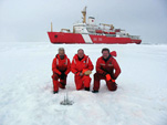
We arrived mid morning at station AG5 and the sampling went smoothly. It is hard to believe that we are now done and steaming for our take out Kugluktuk aka “Kug” which happens on Wednesday, October 3. There is a lot of anticipation about getting home. For the crew of the Louis, it will have been 6 weeks! For most of the science party it has been a mere 4 weeks. But first, before disembarking we must pack. Lots and lots of packing. |
 | 27: Final Words from Cheif Scientist, Cruise Leader - Bill Williams
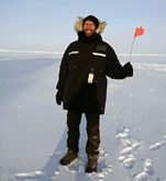
A big thanks to all the science team, and the Captain and crew of the CCGS Louis S. St-Laurent. This has been a very successful 15th expedition and in very good company. Over the last month, we have covered the Beaufort Gyre with our grid of oceanographic stations, completing a huge amount of work with 2 ice stations, the 3 BGOS moorings recovered and redeployed, 69 XCTD casts, 59 CTD/Rosette casts, and 48 bongo net tows. In collecting water for geochemical analysis from the Niskin bottles on the Rosette, the day and night watches have filled over 10,000 sample bottles, most of which have been analyzed on board our team of analysts. |


