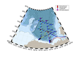
David Jones and Andrey ProshutinskySeptember 8, 2017Weather: 100% cloud cover, 20-25 knot winds, 2-3 meter waves The Joint Ocean Ice Studies (JOIS) 2017 expedition has a plan. Actually there are lots of individual plans but they all have to be carefully coordinated and choreographed so that there is as much efficiency as possible built into the system. That responsibility falls to Bill Williams. He is the leader and guru of the JOIS 2017 expedition. Way in advance of this trip he put together a document titled "Science Plan for the Oceanographic Research aboard the CCGS Louis S. St-Laurent September 7 to October 2, 2017" (pretty catchy eh) which captures all of the planned research activities. There are 29 researchers from 14 institutions representing 3 different countries (Canada, United States, and Japan) that are coordinating efforts on 8 major measurement activities. The great thing about having a plan is it can always be changed. We are in the middle of some fairly rough seas and I woke up at about 2 am last night realizing that I was doing a lot of rolling around. I opted for the rowing machine this morning rather than the treadmill because I figured staying seated in these conditions would be easier than trying to keep my feet under me. I did not want to start the day getting shot off the back end of the treadmill. So long story short rough seas means there is a change in plan. The first CTD cast (AG5 on the map) has been postponed until later and we are headed for the next station (CB1 on the map) by way of Cape Bathurst where the release of surface drifters will take place. Surface drifters are designed to track top layer ocean currents with the use of a GPS transmitter. The scientific plan of this work remains without change: we have to better understand how the Beaufort Gyre climate system (Photos 6 and 7) works. Each element of this system has its own spatial and temporal variability and all elements are closely interconnected. The major goal of this project is to understand these relationships and predict future changes. Different groups of the expedition solve different tasks for each system element and at the same time their work is coordinated to solve numerous scientific problems and questions formulated in the project plan. Since 2002, more than 100 papers have been published focusing on the results of observations and modeling of the Arctic’s Ocean Beaufort Gyre (www.whoi.edu/beaufortgyre). Before the 1970s, Beaufort Gyre was one of the most hostile and inaccessible areas of the globe. In the mid-1920s, there was thought to be land in this region known as the “blind spot”. The first known attempt to investigate the deep Arctic north of Barrow by air was made by Captain Wilkins and Carl Ben Eielson in 1927 who flew 450 nautical miles northwest from Barrow before being forced by bad weather to land on drifting ice at 77°45′N and 175°W. Their measurement of ocean depth at this location showed 5625 m and was the first oceanographic observation in the Beaufort Gyre region. Why has there been so much attention paid by researches to this region since 2002? First, climatologically – the Beaufort Gyre is known as a unique sea ice and water circulation component of the Arctic Ocean (Photo 7) rotating clockwise under the influence of prevailing winds. These winds act as a giant pump collecting low salinity water from the Arctic Ocean surface layer in the BG center. Greater than half of the total Arctic Ocean’s fresh water (45,000 km3) is stored in the Canada Basin with its Beaufort Gyre which contains about 23,000 km3 of fresh water. This volume is practically identical to the volume of water in Lake Baikal, or is comparable with the volume of all of the Great Lakes. It would take five years for all of the Arctic rivers to fill the BG reservoir with its observed fresh water volume. Secondly, the fresh water release from the Beaufort Gyre region can cool down the climate of the Northern Hemisphere. Here is a video explaining this in more detail: Last updated: October 7, 2019 | |||||||||||||||||
Copyright ©2007 Woods Hole Oceanographic Institution, All Rights Reserved, Privacy Policy. | |||||||||||||||||