Please note: You are viewing
the unstyled version of this website. Either your browser does not support CSS
(cascading style sheets) or it has been disabled. Skip
navigation.


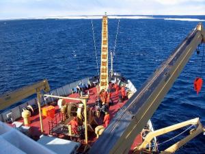
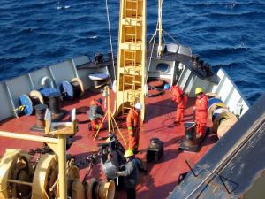
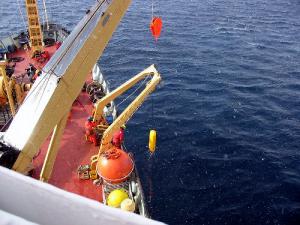
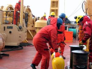
Andrey ProshutinskyAugust 11, 2003The major goal of this day was the recovery of the CABOS mooring system at coordinates 71°N and 134°W, as well as a calibration of the CTD and other instruments. Satellite images, weather maps and results of a reconnaissance helicopter flight to the region of the mooring location showed that the ice conditions were favorable for the mooring recovery. We reached the location at 11:30 a.m. and by 2 p.m. the mooring was recovered. Then the chemistry group began working on the instrument calibrations. The next expedition target will be station 2, located at coordinates 72°N and 150°W. This marks the official beginning of WHOI’s Beaufort Gyre Freshwater Exploration project. The practical confirmation of the fresh water accumulation and release mechanism hypothesis is much more complicated than would be expected because atmospheric, sea ice, and oceanic conditions change from year to year, and in any given year may not correspond to the scheme of circulation proposed in our theory. This theory is based upon climatological, or long-term mean data. Therefore, our fist objective is to detect the location of the salinity minimum in the Beaufort Gyre and to deploy our central mooring in this region. To do this, we will measure the distribution of salinity along the 150°W meridian. Of course, we have to take into account sea ice conditions, because heavy ice could block access to the desired area and time limitations could prevent us from being able to deploy the mooring in the ideal spot. Furthermore, it is quite possible that the atmospheric, sea ice and oceanic circulation may change in 2004 and the salinity minimum could shift locations. This would prohibit us from measuring the most representative seasonal variability of the freshwater content. These concerns were taken into account in the design of our triangular mooring array. Last updated: October 7, 2019 | ||||||||||||||||||
Copyright ©2007 Woods Hole Oceanographic Institution, All Rights Reserved, Privacy Policy. | ||||||||||||||||||