This is an archived site. This site is no longer being maintained or reviewed for broken links.

Please note: You are viewing the unstyled version of this website. Either your browser does not support CSS (cascading style sheets) or it has been disabled. Skip navigation.

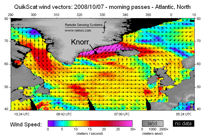
Image : The Angry Irminger by Dallas Murphy


Satellite map of wind speeds in the North Atlantic (note position of ship at the time of this measurement --in the band of highest (30+ knot) winds).  (Remote Sensing Systems)

[back]


Last updated: October 17, 2008


whoi logo

Copyright ©2007 Woods Hole Oceanographic Institution, All Rights Reserved, Privacy Policy.
Problems or questions about the site, please contact webdev@whoi.edu
Site Map