The Great Sinking by Dallas Murphy
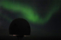
We refer not to ships, but to water. We talked yesterday about convection, the tendency of cold, therefore, dense water to sink. The other component of seawater that contributes to its density is salt, or “salinity.” Today let’s continue to discuss convection by focusing on the Irminger and the important sinking that takes place in these waters. But let’s begin “upstream” of Knorr’s present position and paint a broad, highly simplified picture of the North Atlantic currents in order to understand the specific purposes of Dr. Bob’s study. Every second of every day, the North Atlantic Current—the northward extension of the Gulf Stream—delivers millions of cubic meters of warm, salty water into the northern seas. Some portion of the current proceeds far northward, crossing the submarine ridge that extends between Greenland and Scotland, and circulating in stunningly complex patterns. But the point to bear in mind is that if a certain quantity of water flows north, then an equal quantity must flow south. It’s a law of nature called the “conservation of mass.” Nature likes her ocean and atmospheric systems to go around in circles—circles conserve mass. So all that northward flow in the Gulf Stream System has to find some means of return, and here the ocean performs a fantastic trick. Having sprinted up from the tropics, the Gulf Stream water retains salt left behind by tropical evaporation, so when the water chills, it becomes denser than native northern water. For that reason, it sinks. But “sinking” does not do justice to the spectacularly complex action that takes place in the northern seas. One crucial part of this process takes place right here in the Irminger Sea. As it turns out, the Greenland-Scotland Ridge has some gaps in it, and one such gap is the Denmark Strait in the northern Irminger Sea. This relatively small “nozzle” allows some of the dense water that was formed farther north to squirt southward into the Irminger Sea. The dense water then flows downhill into the deep Irminger basin. We’re not used to visualizing the innards of the ocean in motion, but try to picture two million cubic tons of water per second in violent freefall tearing down an underwater slope. This is a rare, radical move by any ocean water. The waterfall (the “Denmark Strait Overflow” in scientific lingo) dwarfs all terrestrial waterfalls combined, and if it were visible, it would be a World Heritage Site. Tourists from all corners of Earth would flock to see it. After it plunges into the Irminger Sea, the Denmark Strait Overflow water performs another amazing trick. It pulls some of the surrounding “stagnant” water into it and becomes an even stronger current called the Deep Western Boundary Current. This underwater river of dense fluid then proceeds around the southern tip of Greenland and follows the continental slope back southward—under the Gulf Stream--to the East Coast of the United States. And from there it flows all the way to the equator into the Southern Hemisphere. And that is how the ocean returns southward a quantity of water equal to that which flows northward. (By the way, the existence of the Deep Western Boundary Current was first hypothesized in 1960 by a great genius from WHOI, the Shakespeare of oceanography, named Henry Stommel before there were even instruments capable of actually measuring it.) Now we’ve sort of “caught up” with Knorr and Dr. Bob’s project, and soon we’ll examine the Irminger in greater detail and its relationship to climate. By Irminger standards, we’ve had beautiful weather. The wind was down to civilized speeds, the seas reasonably flat. The survey took us to within a mile or less of the Greenland coast. We lined the rail like tourists, and people took pictures of people taking pictures of the glacier, the black-rock mountains, and towering, blue-veined ice bergs at the mouth of Kangerlussuaq Fjord, about 90 miles north of the Arctic Circle. I hear, however, that our weather luck is about to run out. Forty-knot winds are predicted for Sunday evening. Immap ataqatigiinnera allanut tamanut by Nick M?llerUani allaaserineqartumi pingaaruteqarpoq, nunarsuatsinni immap sarfallu qanoq pissuseqarnerat ilisimaarissallugu. Ataani taaneqartut atorlugit immap sarfallu ingerlaarfii paasiniarneqarsinnaapput.
https://www.whoi.edu/cruise/irmingersea/ Imaq Atlantikup imarpissua aqqutigalugu ingerlaarnermini kiattup silaannaa ingerlavigitillugu, imeq silaannannguulluni imaaniit silaannarmut akuleruttarpoq. Taamaasilluni imaq kiattup silaannaaniit avannamut ingerlanermini tarajoqassusia annertusiartortarluni, assersuutigalugu imaq 1 kilo – mi tarajoqassuseq 34 psu – miitillugu (maani imartami tarajoqassuseq taamak annertussuseqarpoq 34 – 35 psu) assigimmagu imaq 1 kilo – mi tarajoq 3,4 gram – imik annerussuseqarluni.
1 kilo imaq Imaq sarfarlu kiattup silaannaa ingerlaviginerani imaq 1 kilomik oqimaassuseqaannarneq ajorpoq, immami kiattumiitilluni imerup silaannannguuttarnermigut, imiup annertussusia imaani annikilluartortarpoq, taamaasilluni taratsut akoqassusia sakkortunerulersarluni. Taannalu imaq tassaavoq tunut avannaata kangianut apissittartoq, tamaanngaanniillu Grønlandshav aammalu Barentshav – mut ingerlaqqikkajuttarluni. Imaq kiattumeersoq grønlandhav – nimut apuussimaleriarluni kujammut Tunup sineriaa atuarlugu ingerlaqqikkaakangami Danmarkstræde aqqusaarlugu ingerlaartarluni, taannatuaavorlu immap sarfaq malillugu kuammut aqqut ataasiusoq, allakkut Grønalandshav – imuut kujammut aqquteqanngilaq. Island – ip Norge – lu akornatigut imartakkut kujammut ingerlaqqissinnaanngilaq, tamaana imaq kiattuneersoq avannamut Grønlandshav – ip tungaanut aqqutaammat. Irmingerip imartaani kissartoq tarajortoorlu imartamut nillertumut tarajukitsumut naapeqatigiittarput, Kalaallit Nunatta avannaaniit imaq nillertoq aammalu sermersuaqarluarneranik pissuteqartumik tarajukinnerulluni tarajoqassusaa 30 % missaaniilluni. Imarli kiattuneersup tarajoqassusia 35 % missaaniikkajuppoq, nikingassut innertunngikkaluarpoq imaanili kisitsisit assingiinnginnerat annertuujuvoq. Imaq tarajoqassutimigut 35 % - miittoq qeriniartarpoq misivisuumik, imartamiit tarajukinnerusumiit naleqqiullugu. Tarajoqassutillu taakku assigiinngitsut naapikkaangamik kisitsisitigut nikingassutimikkut annertunngikkaluarlutik, tarajoqarneq pilertortumik immap naqqanut kivisarpoq, taamaasilluni imaq 35 % - timik tarajulik immap naqqatigut itisuumi nassaassaasarluni, imaq Kalaallit Nunaanat kangiata avannaaneersoq qarajukinnerulluni oqinnerulluni puttallaarinnerusarpoq. Nikingassut annikiginarsinnaagaluarluni imaani kisitsisit nikinganerat annertuupilorujussuuvoq, taamak ilisimatsippaanga ilisimatuut ittuata umiarsuarmiit, isumaqarsimagaluarpungami nikingassut taamak annikitsigisoq peqqutaavallaarnivianngitsoq. Imartat assigiinngittsut ukiut tamaasa naapittarput, imartaq kajattuneersoq kissarpallaarsimappat imartami nillertumi nillusartarpoq, taamatullu imartaq avannaaneersoq tarajukippallaarsimagaangat tarajorterneqartarluni imartamiit tarajoqarluartumiit nunani kiannerusut killiiniit, aammalu killormut. Imaak paasillugu, nunarsuarput nammineerluni aaqqissuuttarpoq naleqatigiissaarluni, piffimmiit piffimmut assigiinngissut nalimmassarlugu. Assilianngorlugu takorlooriarutsigu, nunarsuup imarpissuit taqarisutut illugit, kiak nilleq, qarajoq aammalu immap silaannartaqassusia kaavijaartittarpa ukiorpassuit kingulliit ingerlaneranni. Taamaasilluni nunarsuatsinni inuuniarneq tamanut ajornannginnerulersillugu, kiak avannaanut imaatigut apissittanngikaluaruni, avanna ullumikkut nillernerungaatsiassagaluarpoq inuffigiuminaalluni. Arlaatigut piffimmi ataatsimi imartat ingerlaarfiini allanngortoqassagaluarpat, tamanna piffinnut allanut tamanut assigiinngitsumik sunniuteqassaaq. Sunami tamarmi ataqatigiippoq nunarsuatta kaavittuarnerani. Last updated: October 17, 2008 | |||||||||||||||||
Copyright ©2007 Woods Hole Oceanographic Institution, All Rights Reserved, Privacy Policy. | |||||||||||||||||