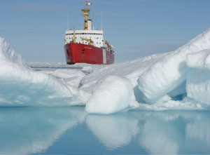
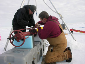
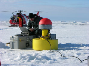
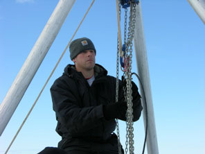
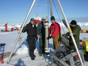
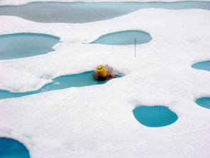
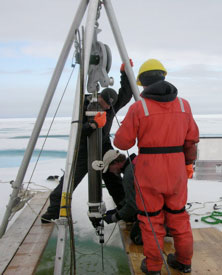
Luc RainvilleAugust 15-16, 2007As we have been progressing east and north (in the direction of the Beaufort Gyre), the ice definitely got thicker and older. It is much whiter and most melt ponds (little lake of melted water on top of the ice) do not go completely through the ice. When Rick and Kris went out on the helicopter to find a nice thick floe for the deployment of another Ice Based Observatory, it didn't take very long before they landed on the perfect piece of ice. The ship steamed towards it and stopped a few hundred meters in front of it. It was a quick flight to bring personnel (the bear watcher -gunman- is always first and last one to go) and gear. Everything went much quicker for this second IBO deployment - the sun even came out for a few hours. For the last few days, we had been monitoring the track of another ice-tethered profiler deployed last year, ITP-4, which hasn't been sending any data from its profiler; we don't know if it is working or not, it sends only the position of the float. In general the ice drift in this part of the Beaufort gyre is towards the south (towards the region we survey every year), so the recovery of ITP-4 was not a high priority for this cruise. However, it turned out that ITP-4 was right along our cruise track, about 10 miles off the 140°W line we are following. Therefore, after the northern-most station on this side of the Beaufort Sea and on our way back to deploy mooring C, we decided to look for ITP-4. Earlier in the night, Rick, Kris, and Denis Lambert (the ice observer) couldn't find it from the helicopter. The last known position was 2 days old, and we had to estimate the drift. After we got the latest position, this time only a few hours old, we drove the ship towards it and it was spotted from the bridge as soon as we reached the area! We stayed with the float all day and the following day (August 17), we successfully recovered ITP-4. A quick look at the profiler indicates that it kept profiling for the whole year (it's last profile was during lunch time on the day of the recovery!). It looks very good, it probably recorded all the data - measurements we would not have got if we had not recovered it! Great news!
Last updated: October 7, 2019 | ||||||||||||||||||||||||||||||||||||||
Copyright ©2007 Woods Hole Oceanographic Institution, All Rights Reserved, Privacy Policy. | ||||||||||||||||||||||||||||||||||||||