Please note: You are viewing the unstyled version of this website. Either your browser does not support CSS (cascading style sheets) or it has been disabled. Skip navigation.

Dispatch 15: From A to B

   Print Change text to small (default) Change text to medium Change text to large

Luc Rainville

August 10, 2007


Actual cruise track (in blue) during the CTD line off Banks Island through multi-year ice, earlier in the cruise. The shortest way is often not a straight line!
The ice observer Denis Lambert's office is filled with ice charts, satellite images, and meteorological maps.
Since you can only see so far from the ship, helicopter recon flights are very useful to find the best way to get to the next stations. Here Denis is drawing leads and floes on is laptop, from 2000 ft high.
  Home, on the edge of a large lead.
 
  Radar are essential for navigation in the ice. Ridges are a strong targets, and areas of open water have little return intensity. This picture, however, was taken just before the recovery of mooring B, in fairly homogeneous first-year ice. Before releasing the float, we broke the ice around the mooring location in a square pattern. The rubble of broken ice along the ship's track is picked up here by the radar, in a 3-mile radius around the ship's location (in the center).
 
Photos by Luc Rainville

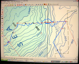
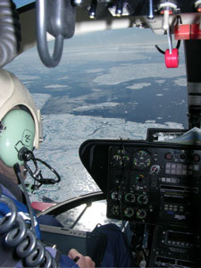
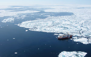
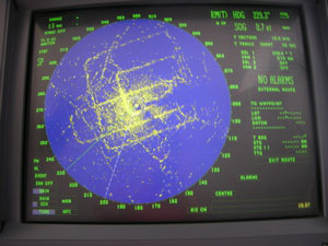
In the Arctic you quickly learn that shortest way is not always the straight line. Navigating through the ice is quite an art. The ice comes in all types, with thickness and resistance that change continuously. The Louis is well equip ed with Radars to find ridges, cracks, and open water area through the thick fog we often have, and the ice observer, Denis Lambert, studies ice conditions from satellite images and helicopter reconnaissance flights to help plan the ship's course and science program.

The ice in this area is surprisingly thin and easy to go through. On the Western part of the Canada Basin, it is all first-year ice (formed last winter) and quite 'rotten'. We encountered older ice and more difficult to navigate through earlier in the cruise. Some of it is certainly due to the powerful engines of the Louis, but we're making great time: going over 10 kts while breaking ice. It's little bit like being on a train, with the occasional jerk to one side when we hit a ridge or some solid old ice floe.

In fact, we were forwarded this piece of news last night, from The Cryosphere Today:

Today, the Northern Hemisphere sea ice area broke the record for the lowest recorded ice area in recorded history. The new record came a full month before the historic summer minimum typically occurs. There is still a month or more of melt likely this year. It is therefore almost certain that the previous 2005 record will be annihilated by the final 2007 annual minima closer to the end of this summer.

In previous record sea ice minima years, ice area anomalies were confined to certain sectors (N. Atlantic, Beaufort/Bering Sea, etc.). The character of 2007's sea ice melt is unique in that it is dramatic and covers the entire Arctic sector. Atlantic, Pacific, and even the central Arctic sectors are showing large negative sea ice area anomalies."

From here, we can say that the ice does seem easy to go through and is very melted in this part of the Beaufort Sea. Impressions can be deceptive, however. The whole reason we are up here is to recover and deploy instruments that will tell us quantitatively how the Arctic ocean works, what changes are happening, and how the Biology, Chemistry, and Physics of the Arctic is responding to these changes.

By the way, to justify the title of this dispatch even more, after leaving mooring A on August 8 we reached and recovered mooring B this morning. The mooring recovery went very well. It was a busy station for all the scientists on board.


Last updated: October 7, 2019


whoi logo

Copyright ©2007 Woods Hole Oceanographic Institution, All Rights Reserved, Privacy Policy.
Problems or questions about the site, please contact webdev@whoi.edu