Luc RainvilleAugust 23, 2007
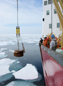
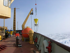
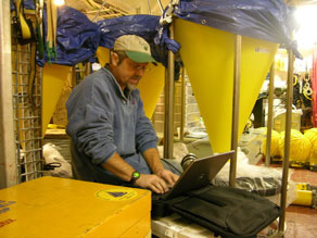
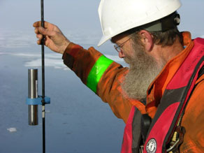
When you are doing a CTD cast in the Beaufort Sea, the first few hundred meters are quite exciting: the surface water is very fresh, then there usually is the temperature maximum of the Pacific summer water, and after another little minimum the temperature starts increasing again, compensated by a steady increase in salinity. You often see intrusions there. But after you reach the temperature maximum of the Atlantic water (between and 300 and 500 meters), some would say that it gets boring. Salinity increases slowly, temperature decreases. Do we really have to go to the bottom? Well, when you look closely, the deep Canada Basin is actually a really cool place... After a minimum near 2400 m, the temperature starts increasing again, even when you remove the pressure effect (because water is slightly compressible, the molecules are closer to each other as pressure increases, increasing temperature slightly). It warms up for by few milli-degrees, and the bottom 1000 meters or so (from 2800 to 3800 m) are a little warmer and completely uniform. The reason for this warming is believed to be the heat released by the Earth's crust (geothermal heating). The vertical mixing and deep circulation in the Arctic ocean are so small than you can see here phenomena that are obscured by other processes in the other oceans. But that's not to say that nothing is happening. Surprisingly, Mary-Louise Timmermans (a scientist at WHOI) and I found from a pilot study a few years ago that the step structure in the temperature profile between the homogeneous bottom layer and the temperature minimum moves vertically by 20-30 meters every 12 hours or so, and there are also lateral intrusions that bring water with different properties at these depths. Very little data have been collected at these depths, but this year we are adding instruments in the deeper part of Moorings A and D to specifically measure the variability in the deepest waters. Steve Manganini (WHOI), along with Tim Eglinton (WHOI) and Roger François (UBC), are also very interested in the deep Canada Basin. He is adding sediment traps to the WHOI moorings, big yellow cones that will catch the particles sinking in the ocean. Collection and analysis of these particles will determine how much carbon is delivered to the deep basin and where it comes from. We are looking forward to determining if most of the sediments are associated with lateral intrusions, ice coverage, or some other exciting transport mechanism! The time series of all the measurements taken on the moorings, from the top to the bottom, help understand the whole story of the circulation and water exchanges around the Beaufort Sea.
Last updated: October 7, 2019 | |||||||||||||||||||||||||||
Copyright ©2007 Woods Hole Oceanographic Institution, All Rights Reserved, Privacy Policy. | |||||||||||||||||||||||||||