Please note: You are viewing
the unstyled version of this website. Either your browser does not support CSS
(cascading style sheets) or it has been disabled. Skip
navigation.
Chris LinderAugust 15, 2005
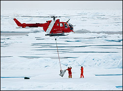
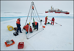
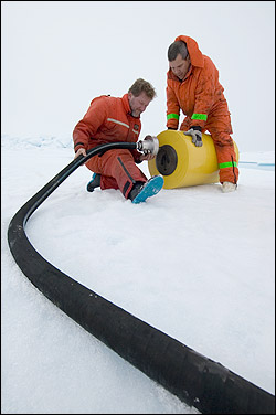
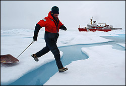
When we woke up this morning, we were within sight of the ice floe Rick and John nicknamed "Camp Smiley" because of the three melt ponds that resembled a giant happy face from the air. The buoy site they selected would give Smiley a yellow dot for a nose. At 9:30AM, a pile of ice augers, instruments, and mooring equipment was assembled in the helicopter hangar. That pile of gear, plus nine people, needed to be moved to the floe. Pilot Christopher Swannell made eight round trip flights between the ship and the ice camp until every last piece of gear was transferred. Then, with a whoosh of rotor blades and a spray of swirling snow in our faces, we were alone on the ice. Our Camp was nine--John Kemp, Rick Krishfield, Kris Newhall, Doug Sieberg, Ryan North, Waldeck Walczowski, Bos'n Bob Taylor, winchman Peter King, and myself. The ship loomed like a big red mountain over the pressure ridges. We were surrounded by electric blue melt ponds and rivers. It was another world entirely, an Arctic moonscape. Rick and John immediately got to work cutting a hole with the ice auger for the ice-tethered profiler (ITP). John was extremely pleased with the floe. "The ice is hard here, and that makes our job so much easier--there is a lot less slush and water coming up through the drill hole. In 10 minutes we easily cut a hole straight to the bottom of this 13 foot thick floe." John, Kris, and Rick then set up a large tripod to support the weight of the anchor and wire. Unlike the other subsurface moorings, this anchor was not designed to rest on the bottom. Dangling from the floe is a line 805 meters long, with a profiling CTD that will crawl up and down that line collecting temperature and salinity data four times per day. Since the yellow top buoy rests on the surface of the floe, it can communicate its position and data back to our computers in Woods Hole every day. This new technology is giving us an unprecedented look at how the Arctic Ocean is changing in real time. While the ITP was being deployed, Doug Sieberg and Ryan North assembled an Ice Mass Balance Buoy, which measures a variety of atmospheric and ice parameters including ice thickness and snow depth. This buoy was developed by our collaborators at the Army Cold Regions Research and Engineering Lab (CRREL) in New Hampshire. The combined data from these two buoys will give us a very thorough picture of the atmosphere and ocean conditions that this ice floe experiences as it travels around the Beaufort Gyre. After six hours on the ice, both buoys were assembled and ready to start measuring. We returned to the ship via one of the Louis' many small boats. This involved a small hike across the ice with our remaining gear piled on sleds. The short trip gave us a renewed appreciation of the hardships Arctic explorers of the past endured. Instead of eating pemmican and huddling under sleds for the night, we had hot meals waiting when we climbed back aboard the Louis, and dry warm beds. After that long, exciting day on the ice, I'm going to sleep well tonight. Last updated: October 7, 2019 | ||||||||||||||||||||||
Copyright ©2007 Woods Hole Oceanographic Institution, All Rights Reserved, Privacy Policy. | ||||||||||||||||||||||


