Please note: You are viewing
the unstyled version of this website. Either your browser does not support CSS
(cascading style sheets) or it has been disabled. Skip
navigation.


Chris LinderAugust 4, 2005
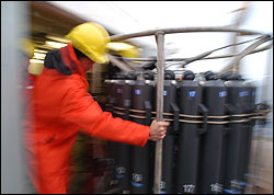
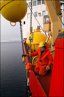
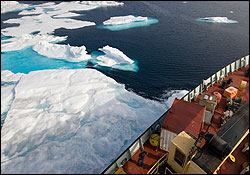
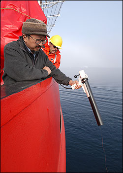
You'll be hearing a lot about moorings in the coming weeks, since we will be deploying six subsurface moorings (meaning the top float is below the surface) and six ice buoys (moorings that hang from buoys frozen into thick ice floes). The moored instruments are vital to this project. They give us information that is similar to what the CTD collects (without the water samples of course), but year-round, when we can't be here. Think of it this way--CTDs are like snapshots, and the moorings like movies. Because of the weight of the components and sometimes miles of cable, retrieving a mooring can be a lengthy, complicated task. Our veteran mooring team and ship's deck crew made it look easy this morning. Within a few hours, the CABOS (Canadian Basin Observing System) mooring was on deck. Principal investigator Igor Polyakov of the International Arctic Research Center uses this data to measure water properties and currents along the continental slope. Although he is not aboard, we were happy to help recover the mooring--in a place this inaccessible, arctic scientists have learned that cooperation is critical to success. For the rest of the day we have been carefully working our way westward along the edge of the ice pack. To the north lies multi-year ice. Compressed from years of accumulation, multi-year ice is deep blue in color and harder than first-year ice. Icebreaking slows us down and uses more fuel, so the Captain has been keeping the bow pointed towards open water. Our next few days are in flux because of some information Rick Krishfield received from Woods Hole today via email... An ice buoy that we intended to retrieve stopped transmitting its position on August 1st. The clock is ticking now if we want to see that buoy--every day it is drifting farther away from the last position it sent. To try to estimate the drift, we will be tracking ice floes in the buoy's vicinity using satellite maps. Still, given how tiny these instruments are compared to the massive size of the floes, this could be the ultimate needle in a haystack. Last updated: October 7, 2019 | ||||||||||||||||||||||
Copyright ©2007 Woods Hole Oceanographic Institution, All Rights Reserved, Privacy Policy. | ||||||||||||||||||||||