Please note: You are viewing
the unstyled version of this website. Either your browser does not support CSS
(cascading style sheets) or it has been disabled. Skip
navigation.
Chris LinderAugust 23, 2005
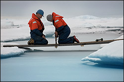
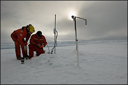
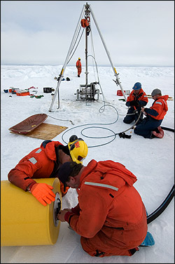
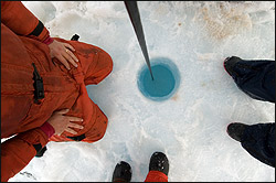
I dubbed today's buoy operation "Camp Persistence" because of yesterday's foiled attempt. Since the small crack was easily stepped over, only one other barrier stood between us and our destination--a lead, or opening in the ice, about fifteen feet across. We didn't know how deep the water was under the half-inch skin of new ice, and we didn't want to find out. Yesterday we took the long way around, but today we had a lot more gear... We needed a flat and level way across. John Kemp and Kris Newhall had measured the opening the day before, and came prepared with oak planks that they assembled into a sturdy bridge. In about ten minutes, sled-loads of ice drilling equipment, a collapsible gantry, and buoy components were being pulled to our site. So far, so good. Once at the site, Rick Krishfield and Doug Sieberg drilled holes for the Cold Regions Research and Engineering Laboratory (CRREL) Ice Mass Balance buoy using a small gas-powered auger. The whirring blades sliced easily downward, revealing an azure blue hole through the multi-year ice. After drilling two more holes, Ryan North and Doug began assembling the buoy--they were old pros, having constructed a similar one at Camp Smiley just over a week ago. The buoy will send data on the ice, snow, and atmosphere back to CRREL scientists using an Argos satellite connection. While Ryan and Doug were busy fitting tubes and attaching instruments, John, Rick, and Kris assembled the three-legged gantry that would support the load for the Ice-Tethered Profiler. Once everything was set up and the reel of wire in place, Kris attached the 250 pound anchor that would keep the mooring line taut. Down the hole it went, followed by 800 meters of wire. Along the way, Rick attached the profiling CTD, which would climb up and down the wire four times per day recording the water temperature, salinity, and pressure. The final component was the yellow, cylindrical top float. The float is more than mere flotation--it serves as the data transfer device. When the profiler finishes its run up the wire, it passes the data up the connecting cable to the circuitry inside the float, and then it makes an iridium satellite phone call to our computers back in Woods Hole. The phone line stays open just long enough to transfer the data file, and then hangs up the line until the next data dump. In that way, we can monitor the water underneath this floe from our desks in Massachusetts for as long as the batteries last--or it is crushed in the ice. After the buoy team returned to the ship, the Captain granted ice liberty to anyone wanting to walk on the floe nearby the ship. A group of about fifteen crew members and scientists put on their parkas and rode the ship's man basket down to the ice. The group posed for photos on a pressure ridge and examined the now iced-over pools of melt water. A dusting of snow on the ice reminded us that summer is ending in the high Arctic. Come September, the ponds will freeze solid and the icescape will transform into a featureless white plain. Starting tonight (fingers crossed) the Ice-Tethered Profiler should make its first trip up the wire. We are hoping to hear from our colleagues in Woods Hole tomorrow whether or not the profiler's maiden voyage was a success. Rick is nervous. "This is the worst part, the waiting" he tells me at dinner tonight. "I can't sleep well until I know that profiler is sending good data." Meanwhile, the engine department continued to reassemble the shaft bearings that caused us to shut down the engines last Thursday night. The latest update is that we could be moving as early as tomorrow evening. Although there are now two new buoys to look at on the surrounding ice pack, we are all eager for a change of scenery. We are also eager to resume our science program, to see how much we can finish in the time we have remaining. Last updated: October 7, 2019 | ||||||||||||||||||||||
Copyright ©2007 Woods Hole Oceanographic Institution, All Rights Reserved, Privacy Policy. | ||||||||||||||||||||||


