Please note: You are viewing
the unstyled version of this website. Either your browser does not support CSS
(cascading style sheets) or it has been disabled. Skip
navigation.
Chris LinderAugust 6, 2005
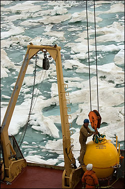
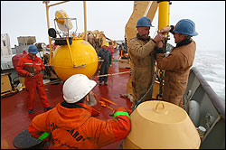
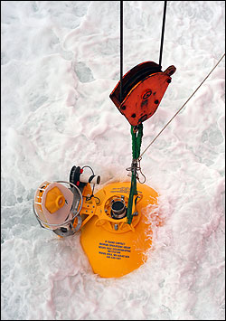
Today's primary objective was to deploy a mooring on the continental shelf northeast of Point Barrow, the northernmost point in the United States. The mooring is a continuation of a major three-year effort to understand how Pacific waters coming through the Bering Strait interact with the deep Arctic basins. Principal investigator Bob Pickart of the Woods Hole Oceanographic Institution is using the mooring data to study the complex interaction of waters at the edge of the arctic shelf. For more information about the 2002-2004 Shelf-Basin interactions project, check out the Arctic Edge website. When we finally reached the mooring site, we realized the battle with the ice was only just beginning. Mooring technician Kris Newhall described the ice as "a frozen mountain range--monstrous 15 foot thick floes mixed in with a crush of broken bits--a jumble of dirty land-fast ice and multi-year ice. We never saw anything like this last year." Coupled with an intermittent cold rain, these were possibly the worst conditions for a mooring deployment. We knew, though, that time was a precious commodity we couldn't afford to waste--it was now or never. John Kemp, who led the operation today, is one of the most experienced mooring technicians in the world. Over the past 28 years he has spent over 200 days a year on the world's oceans setting moorings. We also had the advantage of the Louis S. St-Laurent's secret weapon--the "bubblers." When needed, the Louis can blast ice out of the way using a high-pressure stream of air. Sure enough, after about an hour of work John was pulling the quick release to send the mooring down to the depths. We were elated to complete such a difficult mooring--a testimony to the excellent teamwork displayed by the mooring techs and the Louis' deck and bridge crews. Later, over a dinner of pizza, IOS student Ryan North asked John Kemp "so was the mooring a success?" John replied with a wry smile "I'll tell you in a year!" This mooring, like all arctic moorings, has a top float that is located 50 meters below the surface. While this keeps the instruments safe from being smashed by the jagged bottoms of ice floes, known as ice keels, it also prevents the mooring from communicating with satellites. So, we won't know if the instruments are working until next year when we retrieve them. We can only hope that the years of research and development in designing the equipment have paid off. As I finish this dispatch the rumbling has resumed--our bow pointed north, we are heading into thicker and bigger floes. Stay tuned for more updates from the Beaufort Gyre. Last updated: October 7, 2019 | ||||||||||||||||||||||
Copyright ©2007 Woods Hole Oceanographic Institution, All Rights Reserved, Privacy Policy. | ||||||||||||||||||||||


