Please note: You are viewing
the unstyled version of this website. Either your browser does not support CSS
(cascading style sheets) or it has been disabled. Skip
navigation.


Rick KrishfieldAugust 5, 2006
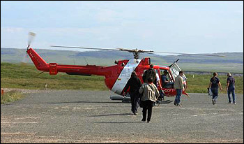
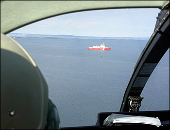
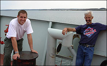
Kris Newhall, Will Ostrom, and I make up the WHOI portion of an international group of scientists who will be conducting oceanographic studies in the Canadian Basin of the Arctic Ocean from the Canadian Coast Guard Ice Breaker Louis S. St. Laurent as part of the JWACS 2006 cruise. Specifically, this is the fourth out of six years that we will be conducting mooring and buoy deployments and recoveries as part of the BGEP. Other scientists from Canada, Japan, Alaska, New York, Denmark and China will be conducting complementary research of the hydrography, chemistry, biology, geophysics and bathymetry of this inadequately sampled region of the Earth. In addition, this year we have an Inuit marine mammal observer onboard to document the various wildlife that we will encounter. Some of the scientists are already onboard, having joined the ship previously in Resolute or Halifax. We are joining the ship in Kugluktuk (67° 49' N, 115° 09'W), while a television crew from the Canadian Broadcast Corporation is offloaded after recording a documentary in preparation for the International Polar Year, and simultaneously with changing of the ship’s officers and crew. Kugluktuk was formally known as Coppermine before the Nunavut Land Claims Agreement settled the new territory of Nunavut in 1999. Sent by the Hudson’s Bay Company to search the region for copper in the 1770s, Samuel Hearne reached the mouth of the river where the small community of just over 1300 (mostly Inuit) now resides and named it Coppermine. After the Nunavut Land Claims Agreement, the original spelling was intended to be “Qurluqtuq” which means "the place of moving water" in the native Inuinnaqtun language, to reflect its location near the river. However, the spelling was fouled during the official naming process, since Kugluktuk literally means "two startled people". Actually, during this trip we never left the Kugluktuk Airport, but were transported by the ship’s helicopter to the LSL which was anchored just offshore. To see more photos of Kugluktuk, view the photos from the 2003 dispatch. Last updated: October 7, 2019 | |||||||||||||||||||
Copyright ©2007 Woods Hole Oceanographic Institution, All Rights Reserved, Privacy Policy. | |||||||||||||||||||