Please note: You are viewing
the unstyled version of this website. Either your browser does not support CSS
(cascading style sheets) or it has been disabled. Skip
navigation.


Will OstromAugust 13, 2006
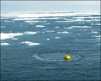
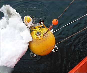
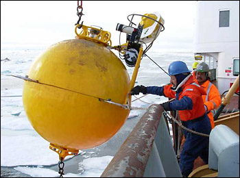
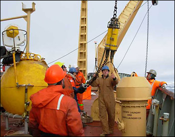
In seawater only 147 m (480 ft) deep, the mooring's mechanical design consisted simply of a large floatation sphere at the top, an 85 m (280 ft) long length of wire rope, several glass flotation spheres, and an acoustic release attached to a large anchor. Attached to the top of the sphere was a profiling winch system to measure the seawater properties above the sphere, and a sonar instrument which determined the thickness of the ice drifting overhead. Oceanographic instrumentation attached to the mooring measured ocean temperatures, salinities, currents and direction over the previous year, and sea level variations from bottom pressure measurements. All this data was recorded internally, so it was necessary to recover the mooring to obtain the results. To read about the scientific objectives of the Beaufort Slope project visit the Arctic Edge website. At noontime we arrived at the site. The ship's position relative to where the mooring would surface was critical. The desire was to have it come up approximately 20 m (65 ft) off the ship's starboard bow. With excellent ship handling from Captain Andrew McNeill on the bridge, the mooring came up just where it was expected. The mooring's bottom end with several 17" glass flotation spheres soon arrived on the surface. The ship then maneuvered alongside the large sphere and hooked it with the crane. The sphere was un-shackled from the mooring wire and stowed on deck. The Lebus winch was then brought into play, winding up the wire rope through a block hung in the A-frame. The scientific instruments on the wire were removed, and the remainder of the mooring was recovered with the ship's crane. The deck operations were completed in only 35 minutes from start to finish, and then it was time to open the instruments and see what information was collected for the past year. Last updated: October 7, 2019 | ||||||||||||||||||||||
Copyright ©2007 Woods Hole Oceanographic Institution, All Rights Reserved, Privacy Policy. | ||||||||||||||||||||||