Please note: You are viewing
the unstyled version of this website. Either your browser does not support CSS
(cascading style sheets) or it has been disabled. Skip
navigation.


Mike Dempsey, Oceanetic MeasurementSeptember 12, 2006
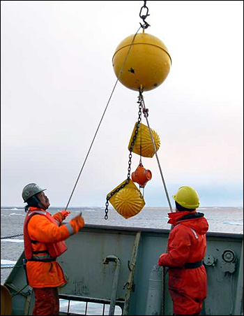
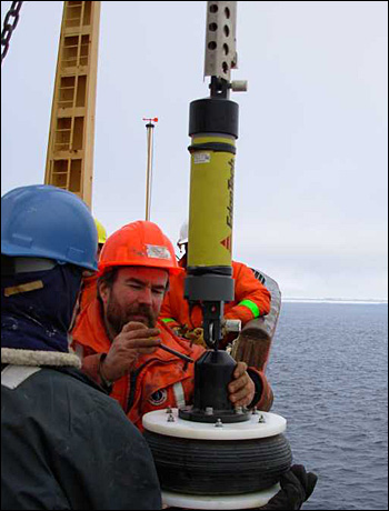
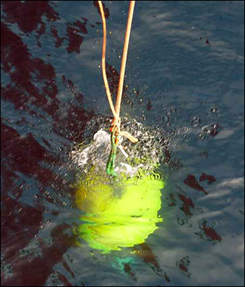
When we were first at the CABOS site back on 8 August (see Dispatch 4), the sea was covered with 8 -9/10 of ridged multiyear ice. Within a couple of hundred metres of the mooring location, ridges poked out up to 5 m high. At that time, it was decided it was better to service the mooring on the way home than spend a lot of time busting ice. After 5 weeks of science, the servicing came down to the wire – the last science operation on the next to last day of the cruise. Luckily the weather was good for mooring work. Tuesday September 12 had good visibility and winds of only 10 – 15 knots. Where the ice had been thick floe to floe, was now only 1-2/10’s, but the ice that remained was old and thick, so a survey of the top transponder was undertaken. Oceanographic moorings can be like tall palm trees in the wind. If there are strong currents, the top can be “blown” away from the anchor and for a mooring thousands of metres long, this could mean a horizontal offset up to 100 metres. For safety, the survey was done and the top float was found to be ~10 m away from the anchor. The word was given and the mooring was released 30 metres off the starboard bow. A quick recovery and then a speedy turn around of the mooring and instruments to make a tight schedule. The mooring was turned around like a Formula 1 race car in the pits with the help of WHOI’s Rick Krishfield, Will Ostrom and Chris Newhall. What was planned to have 4 weeks to accomplish was done in 5 hours! The instruments were downloaded and re-batteried and serviced and it was time to go back in the water. Being the last science operation, the mood on deck was jovial ad relaxed. After 6 nearly six weeks, this Arctic cruise was coming to an end. With a final pop of the Pelican hook, the CABOS mooring was sent to the bottom to observe the ocean temperature, salinity and currents for another year. While we were recovering and deploying CABOS, the Russian icebreaker Kapitan Dranitsyn was servicing the NABOS array. For the last three years, I have worked on the Russian side servicing the NABOS moorings. This year Doug Sieberg (IOS) who has worked on the Louis for many years doing CABOS is servicing the Latev moorings. It has been a wonderful experience seeing another piece of the puzzle on the other side of the world. Last updated: October 7, 2019 | |||||||||||||||||||
Copyright ©2007 Woods Hole Oceanographic Institution, All Rights Reserved, Privacy Policy. | |||||||||||||||||||