Please note: You are viewing
the unstyled version of this website. Either your browser does not support CSS
(cascading style sheets) or it has been disabled. Skip
navigation.
Rick KrishfieldSeptember 4, 2006
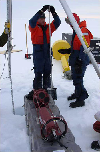
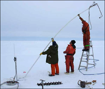
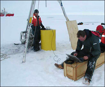
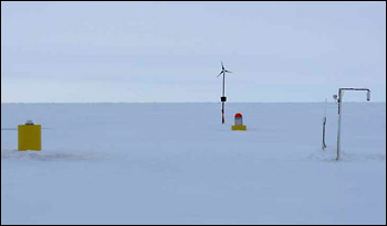
The Arctic scientific community has coined the acronym IBO to signify a cluster of ice-tethered measuring devices deployed and drifting with sea ice to monitor numerous environmental properties in the air, ice, and ocean (see IBO workshop report). IBOs are just one of the technologies that are envisioned as part of an Arctic Observing Network that would provide environmental data from this remote region for scientific and operational purposes. We are all used to hearing about the weather satellites and meteorological stations that collect data for weather forecasts; in a similar way, IBOs would observe the weather (and climate) of the ocean. Here (at approximately 78°N, 140°W) we deployed an IBO that consists of an ITP (see Dispatch 25), an Ice Mass Balance buoy (IMB), and an Arctic Ocean Flux Buoy (AOFB). In addition, Jennifer Hutchings (IARC) deployed a ring of six GPS (Global Positioning System) drifters in a 10 mile radius around the site to study ice deformation. The IMB measures the temperature profile through the ice, ice thickness, snow depth, air temperature and barometric pressure. Generally speaking, the data determines "mass balance" from the difference in the growth and ablation (melt) rates at the top and bottom of the icefloe. The AOFB measures the flux of the heat to the bottom of the icefloe from the perspective of the upper ocean immediately below the icefloe. The ITP measures the seawater properties to a depth of 750 m. All of these systems are designed to last for several years (or as long as the ice allows). Combined, this IBO provides time series of profiles of the near surface atmosphere, ice, and seawater in all seasons while drifting with the sea ice. These data are transmitted via satellites in near real time to our laboratories, and will be shared amongst the scientific community to better understand the mechanisms regulating the Arctic climate. Helicopter operations began after breakfast with a helicopter reconnaissance for an appropriate icefloe to accommodate the needs of all three buoys. A 3 m thick (10 ft) relatively flat icefloe with old ridges around the edges was selected. In addition to the WHOI mooring team, Mike Dempsey (Oceanetic Measurement), Gary Morgan, Bill May, and Joe Illasiak participated on the deployments. Numerous 10", 4" and 2" diameter holes were bored through the ice to deploy the buoys. A tripod was set up to provide the mechanical advantage needed to manipulate the ITP and AOFB buoys, while the IMB could be installed by hand. The AOFB was operational first, then there was a short break for box lunches provided by the galley, then the IMB was completed, and finally the ITP was in place. While the work site was tidied and the ice party transported back to the ship, Jennifer Hutchings and Pat McKeown arrived to install a radar reflector near the buoy array. All were back on board the Louis just in time to catch the end of supper, satisfied with a full and productive day on the ice. Last updated: October 7, 2019 | |||||||||||||||||||||
Copyright ©2007 Woods Hole Oceanographic Institution, All Rights Reserved, Privacy Policy. | |||||||||||||||||||||


