Please note: You are viewing
the unstyled version of this website. Either your browser does not support CSS
(cascading style sheets) or it has been disabled. Skip
navigation.


Thomas Funck, Geological Survey of Denmark and Greenland, GEUSAugust 28, 2006
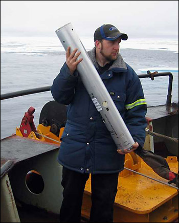
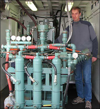
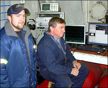
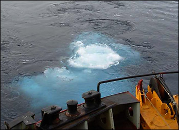
Today we had the chance to test our new equipment over a longer time period and to collect seismic data in an area of Canada Basin where we expect thick sediments. Shortly after breakfast, our seismic sound source was lowered into the water by the deck crew. The source consists of so called air guns. Once a minute we release 1500 cubic inch of compressed air into the water. The pressure of the air is 2000 psi (pounds per square inch), which is 60 times higher than in a regular car tire. The sound propagates to the seafloor and farther below into the sediments. Whenever the sound wave hits a new sediment layer, the sound will be reflected back to the surface, where we are listening with a hydrophone (a kind of very sensitive microphone). In the lab, we do a first quality control on a paper record, which looks similar to an echo sounder. We can see the seafloor and all the different sediment layers below, which could consist for example of mud, clay or sand. Later I take the digital data to my computer and do "magic" things (seismic data processing), which enhance the image of the subsurface. With our airgun and hydrophone we can only measure the time it takes for the sound to travel from the airguns, down to a sediment layer and back to the surface. To determine the sediment thickness we also need to know the velocity with which the sound propagates through the sediments. To do that, our technician Borden Chapman (NRCan) and his summer student (Ryan Pike) deployed a sonobuoy this morning. The sonobuoy is equipped with a hydrophone and a radio transmitter. Back on the ship we receive the radio signal and that way we can listen to our airgun shots as the ship moves away from the buoy. A modeling program in the computer can then calculate the velocity of sound within the various sediment layers. With all that information we can calculate the sediment thickness and use it for Canada's submission to the UN to extend the continental shelf. Everybody onboard is pretty excited about the prospect of making Canada bigger. At the same time, we also get a lot of data that can give us information on the geology of the Arctic and how the 3800-m deep Canada Basin developed over the last 130 million years. Last updated: October 7, 2019 | |||||||||||||||||||||
Copyright ©2007 Woods Hole Oceanographic Institution, All Rights Reserved, Privacy Policy. | |||||||||||||||||||||